 fr
 es
 en
Puigmal
Puigmal
Natura 2000 (Puigmal massif)A border summit between the Cerdagne and the Núria valley, the Puigmal rises to 2,910 metres: a great mountain with gentle slopes, easily reached from Err, at whose foot lies the highest ski resort in the French Pyrenees.
Visit Opening hours, prices, access and events on site ↓Overview
To the east of the Cerdagne, on the border between France and Spain, the Puigmal rises to 2,910 metres. On one side it overlooks the upper Err valley, on the other the Núria valley and its sanctuary, in Catalonia. It is one of the highest peaks in the Pyrénées-Orientales and one of the great classic ascents of the Catalan country.
The glaciers of the Quaternary have left a softened landscape here, with broad, open valleys. The massif gives rise to several rivers, including the Ter, the Freser and the Segre. Its name is said to derive from “puig”, the summit, and perhaps from “mal”, bad, because of its schist soils, poor for livestock.
At the foot of the French slope, the Err-Puigmal ski resort, opened in 1970, was the highest in the French Pyrenees, with runs up to 2,662 metres. Closed in 2013, briefly reopened in 2021, it was placed in compulsory liquidation in 2023; its ski lifts are still in place.
On the French side, the massif is protected by the Natura 2000 network; on the Catalan side, by the Capçaleres del Ter i del Freser natural park. The chamois, almost extinct in the early 1960s, has become common there again, and the rock ptarmigan finds one of its Pyrenean refuges here. The flora includes many rare plants, some of which reach the eastern limit of their range here.
Key figures
- Altitude
- 2,910 m
- Municipalities
- Err (France) and Queralbs (Catalonia)
- Elevation gain from Err
- about 920 m
- Err-Puigmal resort
- opened in 1970, closed in 2013
- Natura 2000 site
- about 8,750 ha
- Núria rack railway
- since 1931
Wildlife, plants and landscapes
A softened glacial landscape
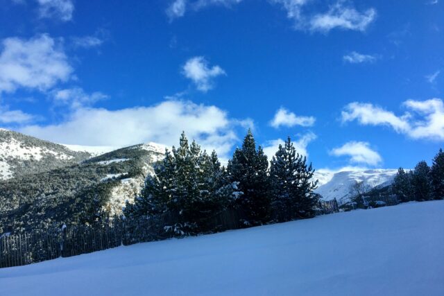
The glaciers left broad, open valleys and gentle slopes, which make the Puigmal an accessible ascent.
The water tower of Catalonia
The Ter, the Freser and the Segre rise in the massif.
The return of the chamois
Almost extinct in the early 1960s, the chamois has become fairly abundant on the massif again.
The rock ptarmigan
This bird of the heights, white in winter, is more abundant here than in most of the Pyrenees, but it is in decline.
A resort asleep
The highest ski resort in the French Pyrenees closed in 2013; its lifts are still standing.
At the summit
A wrought-iron cross bearing the symbols of Núria and a plaque with verses by Jacint Verdaguer greet walkers.
When to go
The ascent can be made from June to October, once the snow has melted; in winter, the summit becomes a ski-touring or snowshoe outing reserved for properly equipped mountaineers. The slopes are steep and exposed to the sun: set off early, carry water and something warm to put on, and come back down before the afternoon storms.
Getting there
The most common starting point is the car park of the former resort, above Err, before the barrier: allow about 2 hours for the climb, with 920 metres of elevation gain, and 4.5 to 5 hours for the round trip. On the Catalan side, you can climb from Núria, served by the rack railway from Ribes de Freser, then reach the summit in about 2 hours.
Not to be missed
- The panorama over the Cerdagne, the Capcir and the Carlit
- The cross and the Verdaguer plaque at the summit
- The border ridge towards the Puigmal de Llo
- The descent towards Núria and its sanctuary
- Chamois, often visible near the summit
Plan your visit
Sources
- INPN : site Natura 2000 FR9101472 « Massif du Puigmal »
- Enciclopèdia catalana : Puigmal-Costabona
- Remontées mécaniques : station du Puigmal
- L’info durable : la plus haute station de ski des Pyrénées-Orientales en liquidation (2023)
- Randozone : le Puigmal
- Wikidata Q17477
Text written by Éden Catalán from these sources. Spotted a mistake? Write to us.